Executive summary Tuhinga whakarāpopoto


What happened
- On 16 May 2024 the Japanese fishing vessel Chokyu Maru No.68 was inbound to the Auckland pilot boarding area when it grounded on rocks near The Noises island group.
- There were 27 crew on board; nobody was injured and there was no pollution as a consequence of the grounding.
- The vessel sustained a small hole at the bow, heavy scraping of the hull paint and minor damage to the propeller. It was refloated later the same day and towed to an Auckland port facility.
Why it happened
- The vessel’s route from Yaizu, Japan to Auckland, New Zealand was not appraised, planned, documented or resourced before departure as required by industry rules and guidelines and standard seafaring practice.
- The crew responsible for navigation did not use all available means to determine the vessel’s position in relation to navigable and unnavigable waters.
- The vessel was not carrying the appropriate nautical publications and large-scale charts that identified local navigational hazards such as The Noises and its outlying rocks.
- The master was not aware of rocks and islands between the vessel and the pilot boarding area and set a straight-line course that encountered these navigational hazards.
What we can learn
A well-researched and documented voyage plan is of fundamental importance to the safety of navigation.
Who may benefit
Maritime operators, managers, regulators and training facilities may all benefit from the findings in this report.
Factual information Pārongo pono
Narrative
- The Chokyu Maru No.68 was a longline fishing vessel registered in Japan. From July 2023 until March 2024 it was docked at the port of Yaizu, Japan. Early in March 2024, the crew prepared the vessel and its gear for a fishing expedition in the Tasman Sea.
- On 23 March 2024 the Chokyu Maru No.68 departed from Yaizu. The master intended to refuel and load provisions in Auckland, where they and the chief engineer were due to leave the vessel and return to Japan. The chosen route from Yaizu to Auckland generally avoided the Exclusive Economic Zones (EEZs) of the Pacific Island nations along the way. The master would set a waypoint on the chart plotter and, when that location was reached, set the next waypoint.
- The Chokyu Maru No.68 arrived in New Zealand waters on 15 April 2024, but was not due at the Auckland pilot boarding area until 0800 (NZST) (from here on, times referred to in this report are New Zealand Standard Time (Universal Time Coordinated + 12 hours)) the following day. The master instructed watchkeepers to stop and drift overnight. At about 1825 the watchkeeper stopped the vessel and it drifted east-northeast of Kawau Island for the next five and a half hours. At about 2355 the watchkeeper resumed the vessel’s passage, and at about 0200 they stopped the vessel outside the pilotage limit and northeast of The Noises (see Figure 3).
- The master came to the bridge at 0245 and along with the chief officer took over the watch at 0300. About 10 minutes later the master resumed the vessel’s approach to the Auckland pilot boarding area and navigated the vessel in a straight line directly from the location where the vessel had been drifting.

(Credit: Land Information New Zealand Toitū Te Whenua, labelled by the Transport Accident Investigation Commission)
- At approximately 0342, while travelling at a speed of around 8 knots, the Chokyu Maru No.68 ran aground on rocks near Motuhoropapa Island. The vessel was hard aground with the tide ebbing, so at low water the bow was high and dry. Initial inspections made by the crew and the harbourmaster’s staff determined that the damage was limited to scraped hull paint and a hole in the forepeak tank. This was later confirmed by a diver’s inspection of the outside of the hull. The diver also observed a small dent in a propeller blade.
- Between 1000 and 1100 the vessel was refloated. Under the guidance of a local pilot, it was then towed into Waitematā Harbour and berthed at a Ports of Auckland facility.

Personnel information
- The master had been working at sea for 52 years and had first sailed as master 40 years earlier. They held a certificate of competency issued under the provisions of the International Convention on Standards of Training, Certification and Watchkeeping for Seafarers, 1978 (STCW), as amended. This qualification allowed them to work as the master on vessels up to 500 gross tonnes (GT) on ocean-going voyages. They had previously visited Auckland in the role of fishing master, when they had been solely involved in fishing activities and had not kept a bridge watch. It was the master’s first trip on board the Chokyu Maru No.68 and their first trip working for Yugen Kaisha Chokyu, the vessel owner. They had joined the vessel on 2 March 2024 at Yaizu.
- The chief officer held a certificate of competency issued under the STCW provisions. This qualification allowed them to work in roles up to the level of 2nd officer on vessels up to 500 GT on ocean-going voyages, and as chief officer on vessels up to 200 GT on ocean-going voyages. The chief officer had worked at sea for 27 years and had worked for Yugen Kaisha Chokyu for six years. They had worked on board the Chokyu Maru No.68 for two years.
Vessel information
- The Chokyu Maru No.68 was 408 GT and built in Japan in 1988. It had previously been named Habomai Maru No.21. Propulsion was provided by a single fixed-pitch propeller driven by a 735 kilowatt (986 horsepower) diesel 4-stroke engine.
Meteorological and ephemeral information
- New Zealand’s MetService Te Ratonga Tirorangi issued a weather forecast for the Hauraki Gulf at 0002 on 16 April 2024. It forecast the following conditions:
- wind – westerly 10 knots rising to south-west 15 knots in the afternoon, then easing to 10 knots in the afternoon
- sea – slight
- swell – north-east one metre easing to half a metre
- weather – thunderstorms possible before dawn, easing late morning.
- Weather observations at Auckland and Whenuapai aerodromes (Whenuapai aerodrome is approximately 15 kilometres northwest of Auckland city centre), between 0000 and 0400 on 16 April 2024, recorded visibility of 18–20 kilometres with some rain showers at Whenuapai.
- Some crew members stated in their interviews that there was fog. The weather recorded in the vessel’s logbook was originally noted as broken cloud but this had been written in pencil and was later erased and changed to fog.
- Satellite radar images provided by MetService showed some rain shower cloud around the Hauraki Gulf/Tīkapa Moana area.
- Tide predictions (from 2024 tide prediction tables published by Land Information New Zealand Toitū Te Whenua) for Auckland were as follows:
- high water, 0103 NZST, 3.1 metres
- low water, 0715 NZST, 1.1 metres
- high water, 1329 NZDT, 2.9 metres
- low water, 1928 NZDT, 1.0 metres.
Site and wreckage information
A dive company, Salt Services 2018 Limited, was engaged by the operator’s agent to inspect the outside of the vessel’s hull. The diver filmed and photographed the vessel’s hull at the accident site. Figures 5–8 are the diver’s photographs showing the extent of damage to the hull.

(Credit: Salt Services 2018 Limited)

(Credit: Salt Services 2018 Limited)

(Credit: Salt Services 2018 Limited)

(Credit: Salt Services 2018 Limited)
Organisational information
The Chokyu Maru No.68 was owned and operated by Yugen Kaisha Chokyu. In Japan, small fishing vessel operators may adopt a formal safety management system, but there is no legal requirement to do so. Yugen Kaisha Chokyu had not adopted a safety management system.
Previous similar occurrences
- On 6 October 1998, the Korean-registered Dong Won 529 grounded on rocks at the southern end of Breaksea Islands, Stewart Island. The Transport Accident Investigation Commission (Commission) identified the following safety issues (Transport Accident Investigation Commission, 1999a):
- poor watchkeeping practices
- preoccupation with non-watchkeeping duties
- inadequate shipboard policies and procedures
- lack of policy and procedure requirements from shore management.
- On 15 December 1998, the Ukrainian-registered Meridian 1 ran aground at the entrance to Bluff Harbour. The Commission found that the watchkeeping officer had been distracted and had not adequately monitored the progress of the vessel. The standards of passage planning, navigational practices and the use of navigation aids were contributing factors to this accident. The Commission raised a safety issue that, compared to fishing operations, masters of fishing vessels placed a low priority on voyage planning and crew resources for operations in confined waters (Transport Accident Investigation Commission, 1999b).
- On 5 April 1993, the Japanese-registered long line fishing vessel Oji Maru No.37 ran aground at full speed on Leschenault Reef, Western Australia. The vessel was en route to Fremantle and the accident occurred 39 nautical miles from the Fremantle pilot boarding area. No injuries or pollution resulted from the grounding. The Australian Transport Safety Bureau found that the master of the Oji Maru No.37 had not navigated the vessel in a professional and careful manner and had not checked the vessel’s position, using the means available, to ensure the vessel followed its planned track. Furthermore, the voyage had not been planned in an acceptable manner, as it was not in accordance with International Maritime Organisation (IMO) recommendations (Australian Transport Safety Bureau, 1994).
Other relevant information
- The International Convention for the Safety of Life at Sea, 1974 (SOLAS) specifies minimum standards for the construction, equipment and operation of vessels. Generally, SOLAS does not apply to fishing vessels due to the differences in design and operation, and other types of vessels. However, Chapter V Safety of Navigation applies to all ships on all voyages (the International Convention for the Safety of Life at Sea (SOLAS), 1974, Chapter V regulation 1.1). Flag state administrations may set the extent to which some of the Chapter V regulations apply to vessels less than 500 GT that are not engaged on international voyages. Japan and New Zealand have both ratified SOLAS. This, and other international maritime conventions, ratified by the New Zealand Government, is given effect in domestic law in the Maritime Transport Act 1994 and the Maritime Rules.
- The International Convention on Standards of Training, Certification and Watchkeeping for Fishing Vessel Personnel (STCW-F), adopted by IMO in 1995, sets the certification and minimum training requirements for crews of seagoing fishing vessels of 24 metres in length and above. STCW-F has been ratified by New Zealand but not by Japan (as of 12 February 2025 https://wwwcdn.imo.org).
Analysis Tātaritanga
Introduction
- The Chokyu Maru No.68 ran aground as it neared the end of its voyage from Yaizu, Japan to Auckland, New Zealand. At the time of the accident the master and chief officer were on watch and the master had control of the vessel.
- In general, commercial vessels have freedom to navigate the high seas without hindrance and to call at foreign ports for fuel and provisions (United Nations Convention on the Law of the Sea (UNCLOS) Part VII High Seas Section 1. General Provisions). The maritime authority of a coastal state generally cannot hamper the innocent passage of a foreign vessel (United Nations Convention on the Law of the Sea (UNCLOS) Part II Territorial Sea and Contiguous Zone Section 3: Innocent Passage in the Territorial Sea, Art 24) and must rely on flag assurance that a foreign vessel entering its ports is operated in a safe and professional manner. A safely operated vessel complies with the laws of its flag state, the laws of the coastal state and all international conventions that apply to the vessel.
- The day-to-day safety of a vessel is the responsibility of the owner/operator and the master, with regulatory oversight from the flag state. In New Zealand there is a shared responsibility between Maritime New Zealand, as the coastal state maritime authority, and regional harbourmasters to ensure the safety of maritime activities and the protection of the marine environment.
- The following section analyses the circumstances surrounding the event to identify those factors that increased the likelihood of the event occurring or increased the severity of its outcome. It also examines any safety issues that have the potential to adversely affect future operations.
Safety of navigation
The voyage planning on Chokyu Maru No.68
- The master and the chief officer had been on watch for about 45 minutes when the Chokyu Maru No.68 ran aground. The master had resumed the vessel’s approach to the Auckland pilot boarding area, using the chart plotter to monitor the vessel’s position and progress towards its destination.
- There was no planned track loaded into the chart plotter or laid out on a paper chart. The paper chart folio on board the Chokyu Maru No.68 did not contain the paper chart NZ 532 ‘Approaches to Auckland’ and there was only a basic coastline indicated on the chart plotter. The smaller islands of the Hauraki Gulf, including The Noises, were not displayed on the chart plotter and there were no physical navigation marks installed to mark this island group. This meant there were no lights to see. Without a copy of the British Admiralty Sailing Directions: New Zealand Pilot (NP51) (the British Admiralty Sailing Directions provide essential information to support port entry and coastal navigation for all classes of ships at sea. Coverage includes the world’s main commercial shipping routes and ports.) or any large-scale chart information, the master and the chief officer were not aware of the navigational hazards in their location. As a result, neither the master nor the chief officer realised that the vessel was heading towards Motuhoropapa Island and its outlying rocks (see Figure 9).

(Credit: Land Information New Zealand Toitū Te Whenua, data and labels added by the Transport Accident Investigation Commission)
- Virtual aids to navigation were located north of The Noises and Ahaaha Rocks. They included “pass to the north” cardinal marks to direct vessels towards safe water. Although these virtual aids to navigation were indicated on large-scale paper charts and would appear on electronic charts, there was no physical buoy or beacon that a watchkeeper could observe.
- The Automatic Identification System signal of the north cardinal mark (located north of Motuhoropapa Island) did not appear on the vessel’s chart plotter, nor was it visible on the radar. The harbourmaster had the crew of the New Zealand Police boat verify that the north cardinal mark was operational on the day of the accident.
- Whether or not this aid to navigation was operational does not diminish the importance of the standard navigational practices of appraising the available nautical information for the area, making a plan that anticipates and avoids the navigational hazards present, and monitoring the vessel’s progress in relation to that plan.
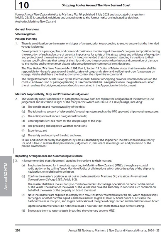
- Maritime New Zealand issues an Annual Notice to mariners (the New Zealand Nautical Almanac is published by Land Information New Zealand Toitū Te Whenua) in the New Zealand Nautical Almanac (see Appendix 1). It contains safety and navigation information, including information on the obligations of the master with respect to safe navigation and passage planning. It also contains directions for the recommended routes around New Zealand and the recommended routes into New Zealand ports.
-
This Annual Notice recommends that masters of visiting vessels use the following route when approaching Auckland from the north:
“Enter Hauraki Gulf/Tikapa Moana through Jellicoe Channel keeping at least 3 nautical miles off land, thence at least 3 nautical miles off Flat Rock, then pass through a point midway between Shearer Rock and The Noises (at least 3 miles off Shearer Rock) before proceeding westwards to intercept the sector light at St Leonards Beach and thence to the Pilot Station.”
The vessel did not have a copy of the New Zealand Nautical Almanac and other appropriate nautical publications, and did not follow the recommended route. - The chart plotter on Chokyu Maru No.68 did not have the electronic charts for New Zealand installed and therefore did not display the small islands of the Hauraki Gulf (see Figure 10 and Figure 11). The differences in detail between the vessel’s installed electronic charts for Japan and those for New Zealand are shown in Figure 12.


- The master and chief officer did not use the chart plotter to review the entire voyage in any appraisal or planning activities, nor did they consult the equivalent large-scale paper charts for New Zealand’s coastal waters and the approaches to Auckland. Their failure to identify prior to departure that only small-scale chart information for New Zealand waters was available on board meant the crew did not have access to all the available information on the navigation hazards that could be anticipated as the vessel approached Auckland.
- Maritime Rules Part 25: Nautical Charts and Publications (Rule 25) applies to foreign vessels within New Zealand coastal limits (Defined in Maritime Rules Part 20.2(a)) and implements New Zealand’s obligations under Chapter V of SOLAS. Rule 25 requires a vessel owner and vessel master to ensure that the vessel carries nautical charts and nautical publications that include tide tables and lists of lights that are appropriate for a vessel’s area of operations (Maritime Rules Part 25.4. 25.5 and 25.6). Nautical charts must be of the largest scale available and suitable for the type of navigation being undertaken (Maritime Rules Part 25.7(a) and (b) and 25.8).
- In this case the vessel was entering Auckland’s Waitematā Harbour and the use of the ‘Approaches to Auckland’ chart was essential. Electronic charts can only meet the chart-carriage requirements if they are part of an Electronic Chart Display and Information System (ECDIS) operated by a person trained in its use (Maritime Rules Part 25.7(c)). The chart plotter on board the Chokyu Maru No.68 was not an ECDIS.
- When the master and the chief officer took over the watch on 16 April 2024, the master set the course to the pilot boarding area based on an incorrect understanding that they had safe water all the way. Had an appraisal been conducted and a formal voyage plan prepared based on the applicable charts and nautical publications, it is virtually certain the navigational hazards would have been identified and a course set that kept the vessel clear of those hazards.

- The Chokyu Maru No.68 had both a starboard radar and a port radar. At the time of the accident, both were operational but only the starboard radar was in use, and it was not directly visible from the master’s chair. Before the accident, the master and chief officer had thought the radar was not working properly because the image was cluttered and unclear.
- The Commission’s investigators found no technical issues with the starboard radar, but noted that the settings meant it was displaying six hours of the vessel’s trail. This meant that the radar echoes were obscured by the trails, making them almost unreadable and unable to be used to enhance their situational awareness and understanding of the navigational features in the area.
International standards for voyage planning and navigation best practice
Safety issue 1: The operator did not ensure that the vessel met international standards for voyage planning and navigation best practice, which meant the crew were unable to anticipate potential navigation hazards along the route, increasing the likelihood of a navigational accident occurring.
- The objective of voyage planning is to establish a safe route from berth to berth – normally from a departure port to a destination port. Vessels commonly travel to destinations that are unfamiliar to the crews, so the maritime industry places great importance on the voyage-planning process.
- STCW prescribes the minimum standards of training, certification and watchkeeping required for seafarers. The master and the chief officer of the Chokyu Maru No.68 held valid STCW certificates of competency. To obtain an STCW certificate of competency a candidate must successfully complete an approved training and education programme and attain a minimum period of sea time. The candidate will also have received training in voyage planning as a fundamental component of navigation practice, including training in interpreting a maritime chart, determining a safe track that ensures a vessel remains in navigable waters, and verifying a vessel’s position along a planned track by various methods.
-
The master of any vessel is obliged to ensure the safety of the vessel and its crew and cargo wherever it may be. The obligation to ensure the safe navigation of a vessel is outlined in SOLAS Chapter V and in New Zealand Annual Notice to Mariners Number 10 (Land Information New Zealand Toitū Te Whenua,2024), which states:
“There is an obligation on the master or skipper of a vessel, prior to proceeding to sea, to ensure that the intended voyage is planned. Development of a passage plan, and close and continuous monitoring of the vessel’s progress and position during the execution of such a plan, are of essential importance for safety of life at sea, safety and efficiency of navigation and protection of the marine environment.”
Similar guidance is published by the Japan Coast Guard as information for masters of vessels visiting Japan (Japan Coast Guard Navigation Safety Division).
-
SOLAS Chapter V, regulation 34, is applicable to all ships on all voyages, and states that:
Prior to proceeding to sea, the master shall ensure that the intended voyage has been planned using the appropriate nautical charts and nautical publications for the area concerned, taking into account the guidelines and recommendations developed by the Organization.
The voyage plan shall identify a route which:
.1 takes into account any relevant ships’ routeing systems;
.2 ensures sufficient sea room for the safe passage of the ship throughout the voyage;
.3 anticipates all known navigational hazards and adverse weather conditions; and
.4 takes into account the marine environmental protection measures that apply, and avoids, so far as possible, actions and activities which could cause damage to the environment (IMO Resolution A.893(21) Guidelines for Voyage Planning, The International Maritime Organization, adopted 25 November 1999).
-
The guidelines referred to in SOLAS Chapter V regulation 34 were adopted on 25 November 1999 (International Maritime Organization, 1999). They state that:
The development of a plan for voyage or passage, as well as the close and continuous monitoring of the vessel’s progress and position during execution of such a plan, are of essential importance for safety of life at sea, safety and efficiency of navigation and protection of the marine environment.
- The guidelines focus on four main areas of navigation planning:
- Appraisal: review of all appropriate and up-to-date information relevant to the contemplated voyage to identify the safest route and familiarise the master and bridge team with the maritime areas that will be visited.
- Planning: preparation of a detailed voyage plan based on the fullest possible appraisal. The plan should cover the entire voyage, from berth to berth. The details of the plan should be clearly marked and recorded on charts and in a voyage plan file. Each voyage plan and details of the plan should be approved by the master prior to the commencement of the voyage.
- Execution: implementation of the voyage plan, taking into account the limitations of the vessel’s equipment, the state of the weather and tides, the traffic conditions and the daytime versus nighttime transits of high-risk areas.
- Monitoring: close and continuous monitoring of the progress of the vessel in accordance with the voyage plan. Any departure from or changes to the voyage plan should be clearly marked and recorded.
- During interview, the master stated that they had been to Auckland before, so roughly knew what course to take. The voyage plan was based primarily on avoiding the EEZs of particular Pacific islands and territories. The master would program a single waypoint towards which the vessel would steer, and once the vessel reached that waypoint the master would manually enter the next waypoint. The master stated that they knew that once they reached the New Zealand EEZ there were only 300 nautical miles to go and to steer 175° to 180° to get to Auckland, so they did not need to refer to paper charts or plan the voyage one step at a time; they just needed to look at the chart plotter. However, they acknowledged that under Japanese law there is a requirement to carry paper charts and not rely on chart plotters or radars alone.
- SOLAS Chapter V regulation 19 and, within New Zealand coastal limits, Rule 25 require all ships – including foreign ships, irrespective of size – to carry nautical charts and publications, to plan and display the routes for the intended voyages, and to plot and monitor the vessels’ positions (the International Convention for the Safety of Life at Sea (SOLAS), 1974, Chapter V regulation 19.2.1.4).
- Chokyu Maru No.68 did not carry a full folio of paper charts, and the charts on board had not been kept up to date. Nautical publications relevant for the voyage to New Zealand were not available on board. The master and the chief officer recalled that the vessel’s chart folio had been transferred from the Chokyu Maru No.88 when that vessel had been sold. They had not realised that a chart relevant to a critical part of the voyage was missing until they were already en route to New Zealand.
- Had a voyage plan been prepared prior to departure, it is likely that the lack of information and missing charts and nautical publications would have been identified.
- The addition of those charts and nautical publications would have supported a full and thorough appraisal of local procedures, landmarks, hazards to navigation and aids to navigation present in New Zealand waters and reduced the risk of a navigational accident.
- Both the master and the chief officer held STCW certificates of competency, certifying that they had been trained, examined and certified to the standards prescribed in STCW, including the fundamental navigation practices. However, the standard of navigation practised on board the Chokyu Maru No.68 prior to the accident did not reach those that could be expected of any deck officer holding an STCW certificate of competency. This was evident because:
- there was no formal, documented voyage plan
- the carriage requirements for nautical charts and publications were not met
- the vessel’s position in relation to navigable and unnavigable waters was not monitored effectively using all available means
- the electronic navigation equipment on board was not set up properly or used effectively.
- Based on their STCW certification, it is reasonable to expect that the master and the chief officer were competent and knowledgeable in the fundamentals of navigation. However, they did not put those skills into practice on board the Chokyu Maru No.68 prior to and during the voyage from Yaizu to Auckland.
Coastal state influence over visiting foreign-flagged fishing vessels
Safety issue 2: New Zealand’s ability to influence the standard of foreign-flagged fishing vessels calling at New Zealand ports is limited. The port state control regime has only recently been extended to include fishing vessels, and as a result there is little data available to coastal states to inform pre-emptive safety measures.
- The IMO conventions and the United Nations Convention on the Law of the Sea (UNCLOS) state the responsibilities and rights of intervention expected from the flag states and port States to ensure that ships meet international standards.
-
The prime responsibility for ensuring a ship meets the required standards rests with the relevant flag state. However, a port state may intervene if the standards are not being upheld and/or there is a risk to the immediate environment arising from the operation of a ship. These rights and responsibilities are explained in a study by the Secretariat of the IMO of the implications of UNCLOS for the IMO (International Maritime Organization, 2014):
1 General
Port State Jurisdiction
By contrast to coastal State jurisdiction, the most important IMO conventions include provisions which regulate port State jurisdiction and the extent to which such jurisdiction should be exercised. It should be noted that, within the context of the implementation of IMO instruments, port State jurisdiction is a concept of an essentially corrective kind: it aims to correct non-compliance or ineffective flag State enforcement of IMO regulations by foreign ships voluntarily in port and is an incentive for flag State compliance.
The exercise of port State jurisdiction for the purpose of correcting deficiencies in the implementation of safety of navigation rules is established in the main IMO safety conventions, namely, Load Lines 1966, 1988 Load Lines Protocol, TONNAGE 1969, SOLAS 1974, SOLAS Protocol 1988, STCW 1978. These treaties regulate the right of the port State to verify the contents of certificates issued by the flag State attesting compliance with safety provisions. They also entitle the port State to inspect the ship if the certificates are not in order or if there are clear grounds to believe that the condition of the ship or of its equipment does not correspond substantially with the particulars of the certificates or if they are not properly maintained. SOLAS provides that the port State may check operational requirements when there are clear grounds for believing that the master or the crew is not familiar with essential shipboard procedure relating to the safety of the ship or procedures set out in the ship's safety management system.
- Maritime New Zealand has published its intention to decrease the risk of catastrophic safety and environmental harm by identifying substandard vessels and dealing effectively with them (Maritime New Zealand Statement of Performance Expectations 2024-2025). In 2023 Maritime New Zealand advised the Commission that since 2022 port state control activity had been significantly enhanced in recognition of its importance, and that it would continue to seek improvements. Maritime New Zealand advised the Commission that it had invested considerable time and resources in the area of port state control, including establishing a Maritime Inspections Team to increase port state control coverage at New Zealand ports.
- Some harbourmasters and port companies in New Zealand have raised concerns with the port state control of foreign-flagged fishing vessels. Maritime New Zealand can inspect visiting foreign-flagged fishing vessels under domestic legislation (Maritime Transport Act 1994 s54) as well as under certain international conventions, but there are limits to the actions it can require of those in charge of the vessels. If the vessel’s operation poses a risk to the safety of human life, Maritime New Zealand can detain the vessel until it is safe to sail and inform the vessel’s flag state and the operator of the vessel’s deficiencies.
- The Tokyo Memorandum of Understanding on Port State Control (the Tokyo MoU) secretariat has acknowledged that fishing vessel safety is a long-standing area of concern. Port state control inspections of fishing vessels have been slow to progress due to the lack of a clear standard and, until recently, no clear repository for the inspection records.
- During 2024 Maritime New Zealand participated in the introduction of measures to extend the Tokyo MoU inspection regime to include fishing vessels. Maritime New Zealand expects that, under the new regime, it will conduct around eight inspections a year based on 20–30% of the expected 25–30 foreign fishing vessels that visit New Zealand each year.
- Over time, as the Tokyo MoU data repository is populated with information on fishing vessel inspections at multiple ports, maritime regulators will be able to identify high-risk fishing vessels and put in place appropriate mitigation measures to maintain maritime safety.
Appendix 1. Excerpts from New Zealand Annual Notice to Mariners, No. 10